Assigning a Cadastral Number to a Land Plot: Everything You Need to Know
Cost of services:
Reviews of our Clients
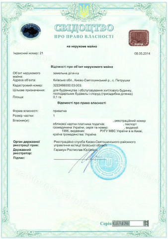
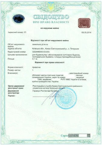
The assignment of a cadastral number to a land parcel is a pivotal aspect of land management. This key process plays an integral role in the establishment, documentation, registration, and regulation of land ownership rights. For anyone involved in real estate or land transactions, acquiring a cadastral number for their property is an indispensable procedure. Being a landowner without a cadastral number can result in various challenges and constraints.
For example, without a cadastral number, your rights over the land and property might be limited. It can also complicate the process of selling or transferring property, as a correctly assigned cadastral number is often necessary. Errors in the cadastre, such as incorrect demarcation of land boundaries, can lead to problems that require updating the State Land Cadastre. This can further complicate scenarios like inheritance or the sale of land.
Obtaining a cadastral number or making necessary updates to it is not a simple task. With over ten years of experience in this field, our team is equipped to offer expert support and assistance in navigating these issues. Our specialists are adept at efficiently assigning cadastral numbers and aiding clients through the various challenges of this process. We not only have the know-how to manage these tasks but also understand their critical importance in the broader spectrum of property transactions.
You may also like: How to Verify a Land Plot in Ukraine Before Purchase?
The Process of Assigning Cadastral Numbers to Land Plots in Ukraine
According to Ukrainian legislation, a land plot is officially recognized from the moment it is assigned a cadastral number. This number serves as a unique identifier, pinpointing the plot's exact location, size, intended purpose, and other key attributes. The assignment of the cadastral number happens during the state registration of the land plot. Once assigned, this identifier remains permanently linked to the land plot throughout its existence, which is essential for both landowners and governmental bodies involved in land regulation.
There's often curiosity about whether it's possible to cancel a cadastral number and what happens to it subsequently. Cancellation is indeed possible, and once a cadastral number is canceled, it cannot be reassigned to another plot. The State Cadastre keeps a permanent record of all canceled cadastral numbers. This permanent record-keeping ensures that the history of the plot can be accessed and reviewed, which is particularly important for conducting legal audits of the land plot before any purchase.
The cadastral number uniquely identifies a land plot and is not influenced by the plot’s location within any administrative or territorial divisions.
The cadastral number serves as an identifier for land plots and is used for various purposes:
- In decisions made by executive bodies and local self-governing authorities regarding the transfer of land for ownership or use. These decisions always include the cadastral number of the land plot, along with details about its location, size, intended purpose, and any restrictions related to property rights.
- When formalizing agreements that confer property rights on real estate, whether it involves residential houses, other buildings, structures, or incomplete construction projects. This requirement is applicable across all forms of property ownership.
It's noteworthy that the transfer of property rights for land plots is formalized through written agreements, which are notarially certified and must explicitly state the cadastral number of the land plot. The cadastral number is a prerequisite for either pledging the land as collateral or for participating in land auctions.
State registration of a land plot entails including its details and unique cadastral number in the State Land Cadastre. Importantly, land plots that came into ownership or use before the year 2004 are deemed legally constituted regardless of having a cadastral number. The state registration of these plots in the cadastre is based on technical land management documentation.
You may also like: Subdivision and Consolidation of Land Plots: Key Stages and Requirements
What steps should you take if the cadastral registry contains errors about your land plot's characteristics?
Errors in the cadastre related to the area, boundaries, or other features of land plots can occasionally occur after their details have been transferred to the cadastre. To address these issues, there are established (pre-litigation) procedures to correct such inaccuracies.
If errors in the size, boundaries, or other aspects of land plots are found following their transfer from the State Land Register to the State Land Cadastre, landowners and users have the option to contact the State Service of Ukraine for Geodesy, Cartography, and Cadastre. This agency is authorized to amend these errors using technical land management documentation or based on land survey records.
Amending Information about a Land Plot in the State Land Cadastre: Changing Boundaries
The process for correcting errors in the cadastre may include altering the boundaries of a land plot, adjusting the placement of a portion of another plot within its confines, or changing its area. It's important to emphasize that any alteration to a land plot's boundaries, as part of rectifying these errors, requires the written consent of the neighboring land plot owners or users. This ensures that the interests of all parties are taken into account and upholds the principles of objectivity, reliability, and completeness of information in the State Land Cadastre.
A cadastral number is assigned to a land plot irrespective of its ownership type. Even when the ownership of the land plot changes hands, new rights over it emerge, or there are alterations to the property rights or other related information, the cadastral number remains consistent. It continues to serve as a stable identifier for that specific land plot.
The only exception: New cadastral numbers are allocated to land plots that result from division or consolidation, as these processes lead to the formation of new entities.
The task of inputting data and compiling information in the State Land Cadastre's registration and information system is handled by state cadastral registrars. These registrars are in charge of updating this system.
They record information about the land plots' boundaries, their usage categories and types, functional zones, irrigation networks, and details regarding plots under sublease or easement rights, as well as the normative monetary evaluation of lands. This information is usually based on land management documentation (such as projects or technical papers), applications, and urban planning documents.
The information entered into the State Land Cadastre is meant to be permanent and stable, and it is not subject to removal.
However, due to the ongoing military situation, access to this data via the Public Cadastral Map is limited. To address this, a pilot project has been launched that enables certified land surveying engineers to input data into the State Land Cadastre. Participants of this project have the necessary access to the State Land Cadastre and use this information for preparing land management documentation.
Addressing Duplicate Cadastral Numbers for Land Plots in Inheritance Cases
We were approached by a client needing help with an inheritance process, specifically addressing a situation where a land plot had been assigned a duplicate cadastral number. The client inherited a land plot that already existed and had a cadastral number, but these details hadn't been recorded in the State Land Cadastre. When this information was being entered into the Cadastre, an error was found: the plot was assigned a cadastral number that was already in use for another plot belonging to someone else.
Our first step in resolving this issue was to reach out to the cadastral registrar responsible for assigning the new number to the land plot. We received a written explanation from the registrar, detailing the circumstances and reasoning behind the assignment of the new cadastral number. This information was critical for effectively addressing the issue. Next, we contacted the state registrar of property rights to facilitate the registration of the client's inheritance rights in the real estate registry, following the established procedures. This action legally formalized the ownership of the land plot in the name of the heir, resolving the complex issue.
In similar situations, clients can count on our expert assistance, which includes:
- Handling the formalization of inheritance rights to a land plot in Ukraine.
- Assisting in the coordination of any changes to land plot rights.
- Providing expert inspection of real estate before purchase, including land plots.
- Assigning cadastral identification numbers to land plots.
- Managing land plot transactions in Ukraine, such as sales and gifts.
Our team ensures comprehensive support and consultation for resolving legal matters related to real estate and land rights.
For details on the cost of our legal services in land law, please refer here.
For information about the costs of legal support in real estate transactions, please refer here.


